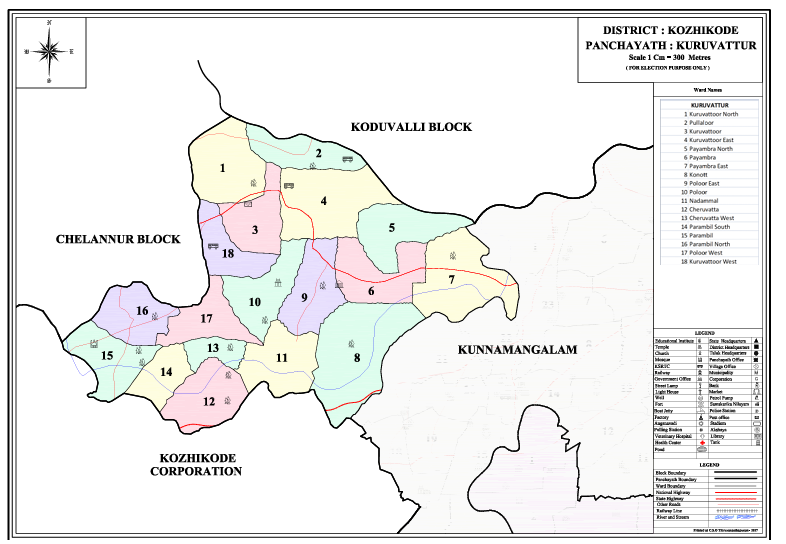
GRAMA PANCHAYATH MAP 2010
Kuruvattoor Grama Panchayat: Geography
1. Location
- District: Kozhikode District
- Taluk: Kozhikode
- Block: Kunnamangalam
- Village: Pirayiri
2. Area
The total area of Kuruvattoor Grama Panchayat is 17.94 square kilometres.
3. Boundaries
- South: Kunnamangalam Panchayat and Kozhikode Corporation
- North: Chelannur and Madavoor Panchayats
- East: Kunnamangalam Panchayat
- West: Kakkodi and Chelannur Panchayats and Kozhikode Corporation
4. Major Localities / Desoms
The major localities (Desoms) coming under the jurisdiction of the Kuruvattoor Village Office are:
- Kuruvattoor
- Konott
- Cheruvatta
- Payambra
- Parambil
- Pullalloor
- Poloor
5. Nature of Soil
Kozhikode District can generally be divided into three geographical regions: Highlands, Midlands, and Lowlands. Kuruvattoor is situated in a region associated with the Midlands.
Among the major soil types found in the district, laterite soil is also likely to be found in this area.